

Bridge Damaged on Road Linking Thanh Hoa to Nghi Son Economic Zone
Rain from the evening of November 8 into November 9 damaged a bridge on a national highway linking Thanh Hoa’s mountainous areas to Nghi Son Economic Zone. Part of the bridge abutment collapsed, leaving the road impassable. Local authorities have requested an inspection and repairs, while forecasters expect more heavy rain on November 9.

On the morning of November 9, Lê Văn Nghĩa, Party secretary of Thanh Kỳ commune in Thanh Hoa province, said heavy rain that began on the evening of November 8 had sharply increased upstream flows, damaging a bridge at Km24+987 on the Nghi Sơn–Bãi Trành national highway. Parts of the bridge abutment collapsed, cracks appeared in the asphalt concrete road surface, and vehicles can no longer pass. The route links the mountainous area and the Ho Chi Minh Highway with Nghi Sơn Economic Zone and normally carries heavy traffic.
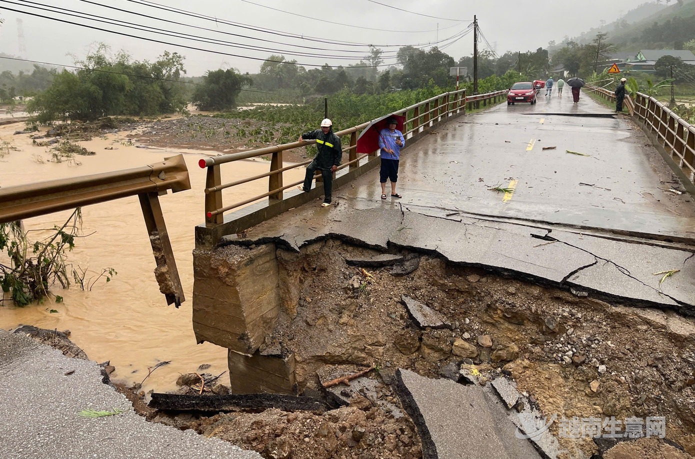
Part of the damaged bridge’s abutment collapsed.(VietVance)
Lê Văn Nghĩa said the incident caused no loss of life or damage to vehicles, but disrupted residents’ travel. Rain on the evening of November 8 also flooded dozens of stream crossings. Thanh Kỳ commune has reported the damage to the Thanh Hoa Provincial People’s Committee to seek a plan for inspecting and repairing the bridge.

Heavy rain damaged a bridge on a road linking to Nghi Sơn Economic Zone.(VietVance)
Thanh Hoa’s meteorological and hydrological agency said moderate to heavy rain fell across the province from the night of November 8 into the early morning of November 9, with very heavy rain and thunderstorms in some areas. With a strengthened cold air mass affecting the region, the agency forecast continued heavy rain on November 9: generally 40–80 mm across the coastal plains and western and southwestern mountains, with more than 100 mm in some places; and generally 30–60 mm elsewhere, with more than 70 mm in some places. Rainfall could exceed 100 mm in three hours in isolated areas.
The meteorological agency warned of possible flooding 0.2–0.7 meters deep in Thanh Kỳ and other areas, along with a high risk of flash floods along small rivers and streams and landslides on steep slopes. Thanh Hoa’s civil defense command issued a Level II alert for the Yên River at the Chuối hydrological station, calling on local authorities to take response measures, protect dikes and prepare to evacuate residents of riverside floodplain areas.
Source: VietVance