
Hanoi Proposes 267-Hectare Ngọc Hồi Station Complex
Hanoi’s Department of Construction is seeking feedback on a 1:500 detailed plan for the approximately 267-hectare Ngọc Hồi station complex, which would connect the North–South high-speed railway, the national railway and five metro lines alongside a transit-oriented urban area.

Hanoi’s Department of Construction recently invited the Vietnam Railway Authority, Vietnam Railways Corporation and relevant agencies to comment on the draft 1:500 detailed plan for the Ngọc Hồi station complex. The proposed study area covers about 267 hectares in Ngọc Hồi and is designed to serve a projected population of 56,720. The project would integrate the North–South high-speed railway, the national railway and Hanoi metro lines 1, 3, 6, 12 and 13.
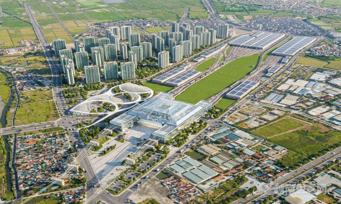
An illustration of the plan to connect the Ngọc Hồi station complex to the North–South high-speed railway and five metro lines.(VietVance)
The plan divides the complex into a 152.2-hectare railway hub and a 114.9-hectare transit-oriented urban area. Under the illustrative design, the main station would have three above-ground floors and one basement level. The basement would accommodate metro stations and railway operations facilities, while the ground level would connect the eastern and western squares. The above-ground floors would house passenger services, platforms for national and high-speed rail, and administrative, service and training areas.
The plan also allocates 43 hectares in the urban area for apartments in buildings of up to 35 floors, along with about 10 hectares for education, healthcare and sports facilities. The station would connect to National Highway 1, ring roads and other major nearby roads, with internal roads and shared underground space also planned.
Consultants estimate that by 2050, the station would handle 62 million high-speed rail passenger trips and 19.4 million national rail passenger trips annually. The five metro lines would have capacity to serve about 247,500 passenger trips a day. Hanoi’s municipal government would be responsible for land acquisition and procedures for land allocation and leasing; investors or project companies would undertake infrastructure investment and operations. Farmland accounts for about 40% of the planning area, while ponds and marshes account for about 27%. Treating soft ground and managing drainage are the project’s main challenges.
Source: VietVance