
Thái Nguyên Plans Northern Urban Center Covering About 46,800 Hectares
A draft master plan for Thái Nguyên province’s northern urban center was discussed on November 8, 2026. Covering more than 46,700 hectares through 2050, it proposes a multipolar layout with an urban core, a northern development area and a tourism services area, alongside transport and environmental infrastructure improvements.

On the morning of November 8, 2026, Bắc Kạn ward held a meeting to discuss a draft master plan for Thái Nguyên province’s northern urban center through 2050. According to the consulting firm, the planning study area covers more than 46,765 hectares and includes the entire administrative areas of Bắc Kạn and Đức Xuân wards and Phong Quang, Phủ Thông and Cẩm Giàng communes. The proposal still needs to be finalized before it is submitted to the competent authorities for review and approval.
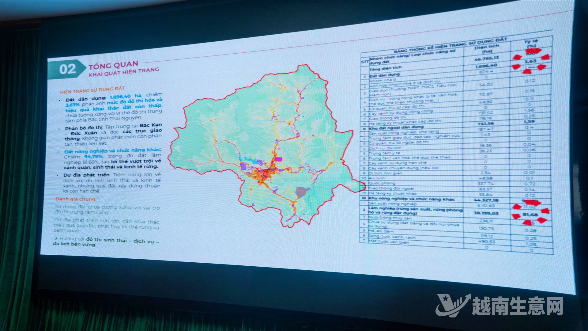
A map of the study area for Thái Nguyên province’s northern urban center plan, covering two wards and three communes and approximately 46,765.13 hectares.(VietVance)
The area had a population of 71,629 in 2025, with more than 61% concentrated in the Bắc Kạn–Đức Xuân urban core. Under the province’s spatial development plan following the merger of Thái Nguyên and Bắc Kạn, the northern urban center is designated as one of four major urban centers. It is intended to serve as a trade hub and a gateway linking Hanoi with Vietnam’s northern midland and mountainous regions.
The draft plan proposes shifting from a linear urban layout to a multipolar one linked to expressway access points. It identifies the Bắc Kạn–Đức Xuân urban core, a northern development area in Phủ Thông–Cẩm Giàng, a tourism services area in Phong Quang, and industrial and logistics centers. It also calls for upgrades to the Hanoi–Thái Nguyên–Bắc Kạn–Cao Bằng Expressway (CT.07) and National Highways 3, 3B and 280, as well as stronger regional transport links.
The proposal also covers sustainable drainage, retention lakes, wider river and stream protection corridors, solid waste management, forest ecosystem conservation and development of economic activities beneath the forest canopy. Meeting participants generally agreed on the need for the plan and its strategic direction. They also urged the consulting firm to provide supporting evidence for its Class II urban classification indicators and clarify measures for infrastructure connections, drainage and protection of the Cầu River ecological corridor.
Source: VietVance